
Each item in the View menu allows you to change what is shown on the map.
Click Zoom extents to zoom out to the greatest extent of the home page map.

Base Layer
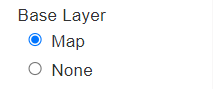
Select either Map or None.
Select None to remove the map background and only view the assets with no map reference.
Overlays
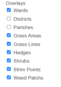
The overlays determine the assets and information visible over the basemap layer.
The local authority electoral ward boundaries are displayed as a red line over the map. You may also see options for Parishes, Districts or other local authority areas.
Asset Types - The default asset types are shown here and you can select which to display:
- Grass Areas - A polygon that defines the area to be cut.
- Grass Lines - A line that requires a set width cut or strim (e.g. 1.5 carriageway verge cuts)
- Hedges - A line that defines a hedge which requires either hand or mechanical flail cuts.
- Shrubs - A polygon that describes an area of shrubbery which requires trimming.
- Strim Points - Lines or points that require strimming around obstacles such as signposts, bins or along fencelines and flower patches.
- Weed patches - Polygons to define a patch of weeds that need manual removal or chemical treatment.